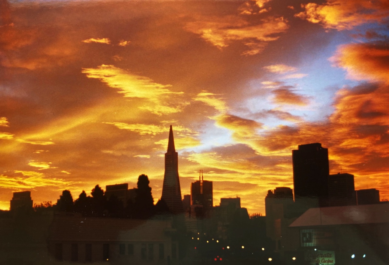
The North Beach Project
Neighborhood Scale
North Beach is one of the most distinctive neighborhoods in San Francisco. In 2007, the American Planning Association named it one of its top 10 neighborhoods in the United States. What if a "modern" urban feature was dropped in the middle of it?
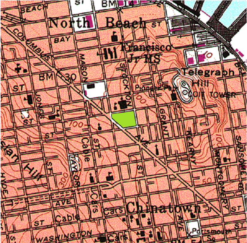
Each map below is centered on Washington Square, which is colored green. Streets are preserved as light dashed lines. Both the base map and the insert are oriented the same, so that north is up, and each map is the same scale.
In college, I began researching infrastructure projects, including tansit, rail, bridges, and highways. Soon out of college, I prepared a report that suggested the routes and strategies for exteding Caltrain into downtown San Francisco were sub-optimal. Why not bring the trains to a re-built Transbay Transit Terminal? The Emperor Norton Project was the result and it led to the Salesforce Transit Center that we have today and the proposed DTX project. That was 30 years ago.
North Beach Base
Centered on Washington Square, colored green
North Beach is home to
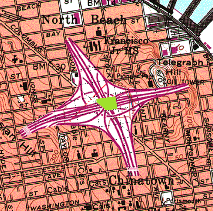
San Jose, I-280 / SR-87 Interchange
I-280 runs east-west, SR-87 runs north-south
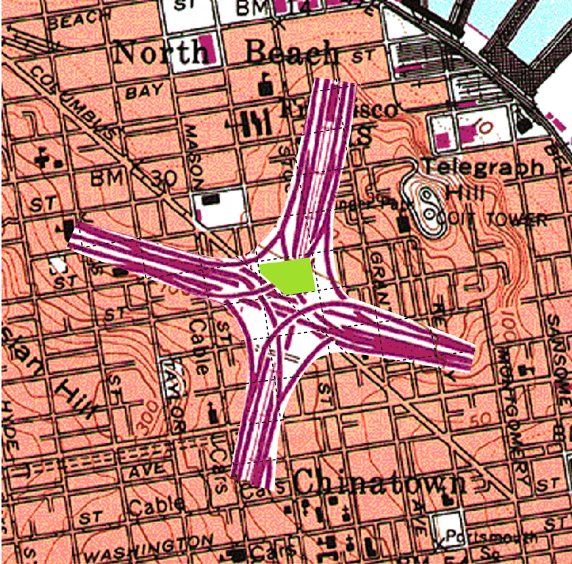
Oakland, I-580 / SR-24 Interchange
I-580 runs east-west, SR-24 runs north-south, Macarthur BART station at top
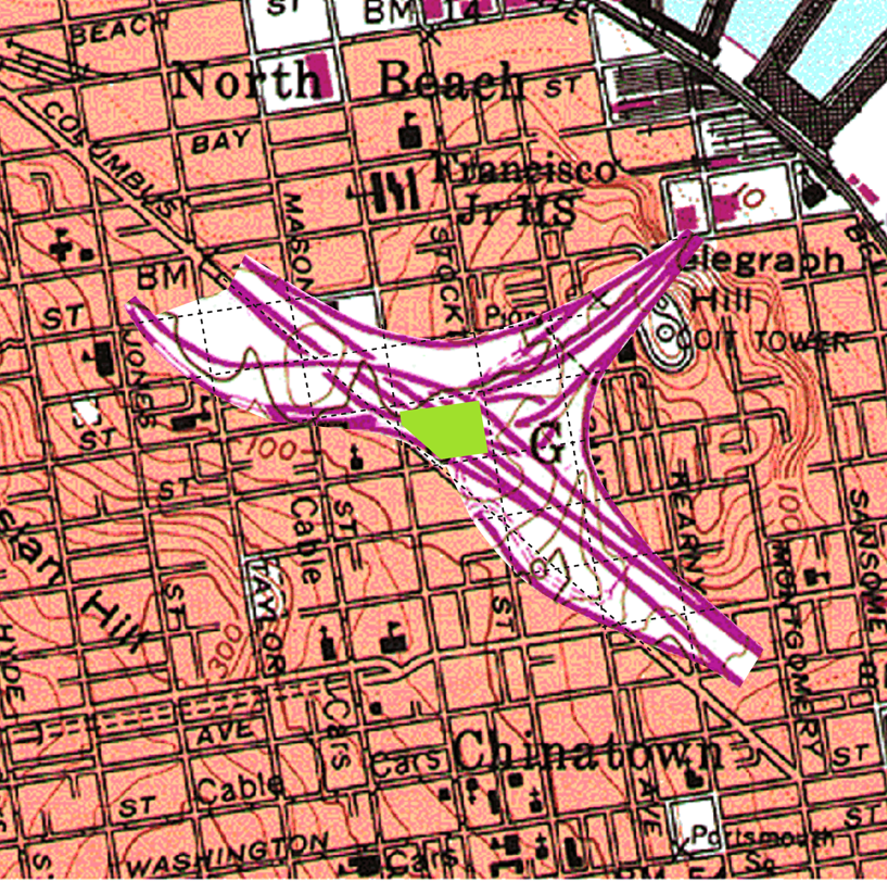
San Mateo, I-280 / SR-92 Interchange
I-280 runs diagonally, SR-92 intersects and curves north
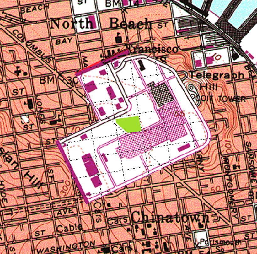
Hayward - Southland Mall
I-880 passes at top of mall
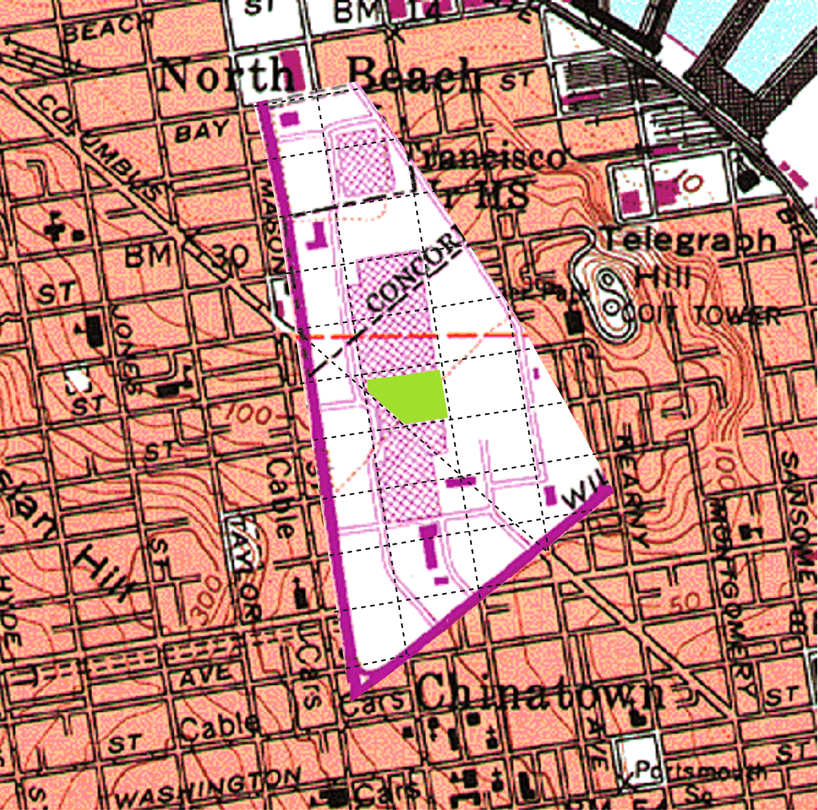
Concord - Sun Valley Mall
Willow Pass Road on the bottom, I-680 passes east of the mall
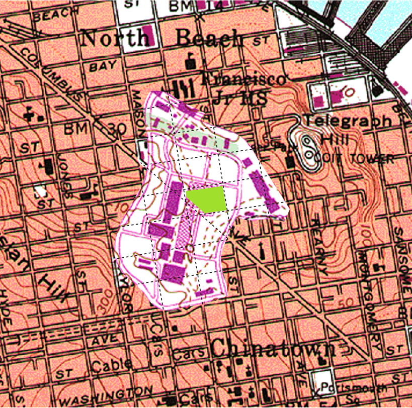
San Rafael - Northgate Mall
Freitas Parkway at the top of map, US 101 passes to the east
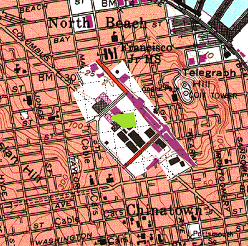
San Mateo - Hillsdale Mall
El Camino Real runs north-south, Hillsdale Avenue crosses diagonally
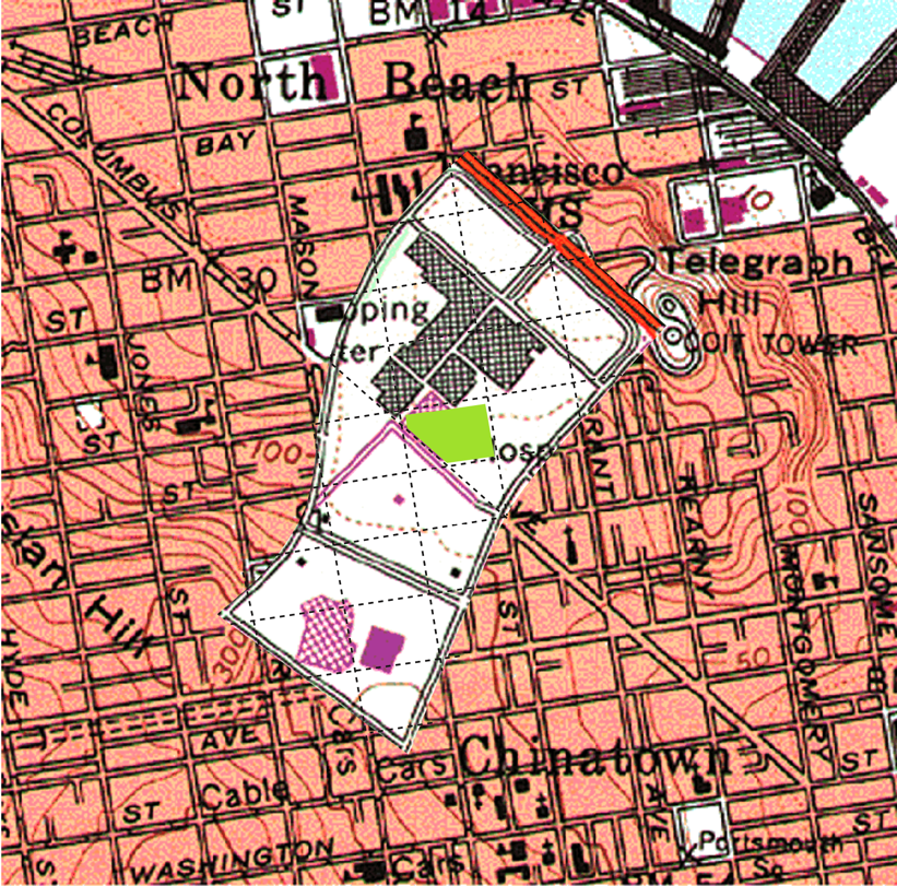
Palo Alto - Stanford Shopping Center
El Camino Real runs diagonally at top, Sand Hill Road on the west edge
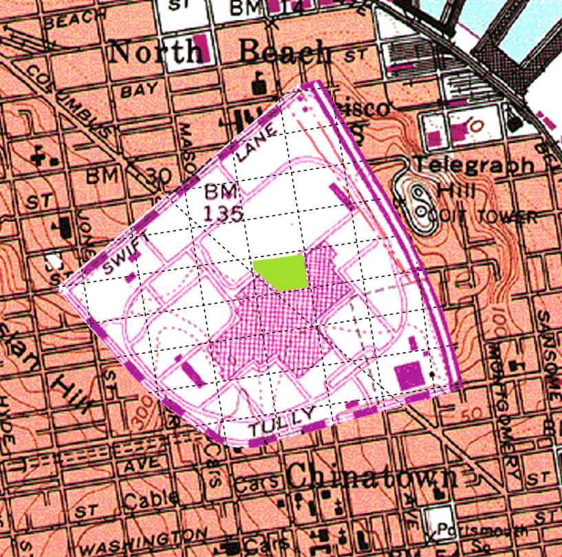
San Jose - Eastridge Mall
Capitol Expressway on eastern edge
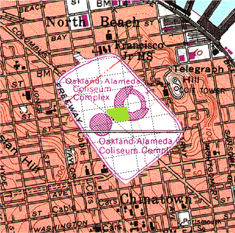
Oakland Coliseum and Arena
I-880 on western edge
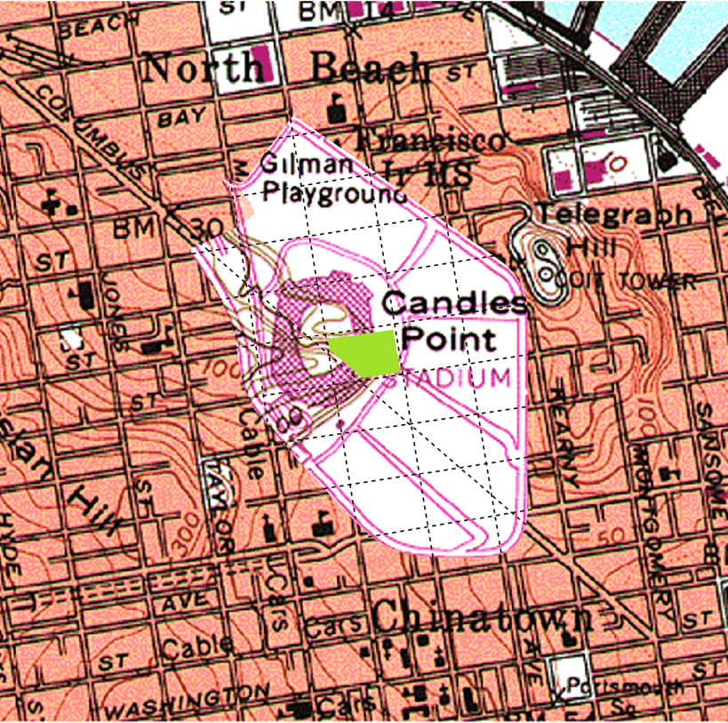
Candlestick Park (Rest in Peace)
San Francisco's home to the SF Giants, 1960-1999, 49er's, 1971-2014
